AI is quickly becoming a baseline expectation in mineral exploration. Though there’s still skepticism from veterans, the next generation of geoscientists is inheriting this reality before even setting foot in industry. The question is no longer whether these tools will be part of the workflow, but whether emerging practitioners are prepared to apply them with the geological context and human judgement that make them valuable.
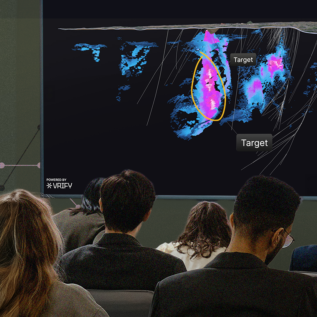
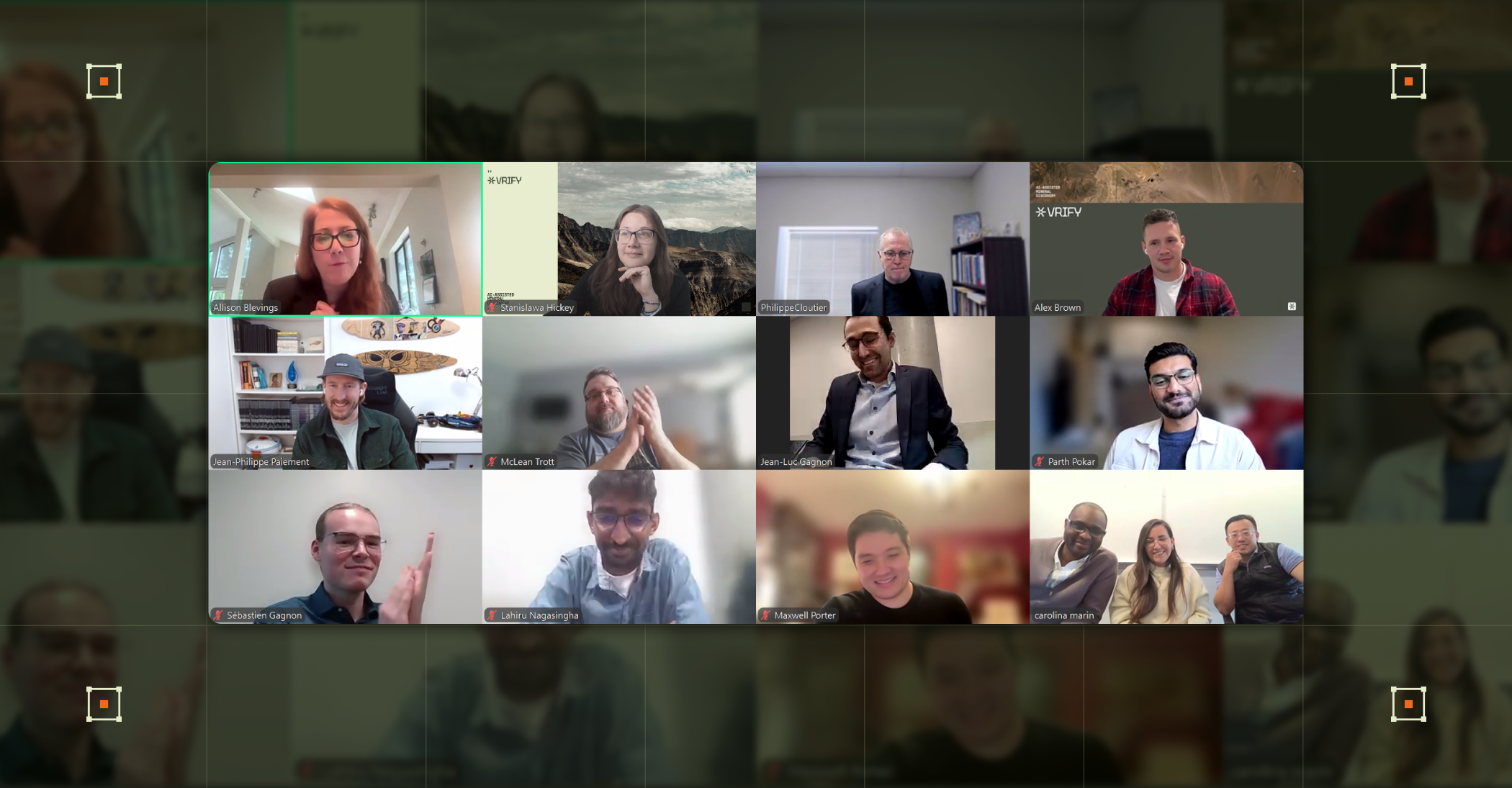
VRIFY’s 2026 Student Challenge was built around that question. Open to students and postdoctoral researchers at Canadian universities, the contest ultimately drew teams from 10 institutions across the country. They were asked to use DORA, our AI prospectivity mapping software, with an anonymized real-world dataset to generate and interpret targets through a geological lens and then propose an exploration strategy based on their findings. Below, the top three teams — including the winning team — reflect on what the experience revealed and where exploration is heading.
Team φrex
Winner and First Place
Members: Lahiru Nagasingha, Jean-Luc Gagnon, and Sébastien Gagnon
Polytechnique Montréal
φrex is a three-person team from Polytechnique Montréal that formed around an opportunity Lahiru Nagasingha had been looking for. As a PhD candidate developing uncertainty-aware probabilistic machine-learning frameworks for mineral prospectivity modelling, Lahiru kept running into a national-scale limitation: uneven data resolution and sparse borehole coverage across Canada. This gap makes it difficult to confidently define what “barren” looks like alongside what is mineralized. The Student Challenge offered a richer regional-scale dataset that included borehole information, and it gave him a strong setting to apply his knowledge. He was joined by Jean-Luc Gagnon and Sébastien Gagnon, both of whom are pursuing master’s degrees. Jean-Luc is studying engineering physics with a focus on the application of effective medium theory to induced polarization for mineral exploration, while Sébastien’s work in mineral engineering examines fractured rock and permafrost characterization through geoelectrical methods.
Below are their reflections after completing the Student Challenge in early 2026:
1. What were the challenges you faced using DORA, and how did you overcome them?
Team φrex: One of our main challenges was input feature selection. Simply adding more features does not guarantee a better model. So rather than including every available variable, we took a collaborative approach, drawing on each other’s domain knowledge to map the components of the orogenic gold mineral system to the available geoscience features.
This ensured that every input to the model was geologically justified and representative of the source, pathway, and trap elements of the mineral system. It was a time-intensive process, but it ultimately made our results far more interpretable and geologically meaningful.
2. Can you share one insight from DORA that influenced how you approached targeting or strategy?
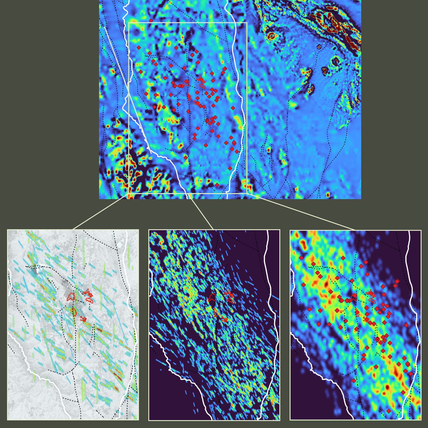
Team φrex: One key insight was the importance of not relying on a single model output. For example, DORA offered four deep learning models for orogenic gold, each trained with a different number of training patches, and we also incorporated two VMS (volcanogenic massive sulphide) models into our analysis.
By running those available models and carrying out an uncertainty analysis across their outputs, we were able to identify where multiple models consistently agreed and where they differed. This allowed us to construct a risk-return map, giving us a clearer picture of not just where to explore, but how much confidence to place in each target.
3. Did using DORA change your perspective on the practical applications of AI in mineral exploration?
Team φrex: It reinforced something Lahiru has always believed: A mineral prospectivity map is not a treasure map. It is a tool that supports and guides exploration decision-making, and it is most effective when paired with geological expertise.
For instance, DORA’s SHAP (Shapley Additive Explanations) analysis allowed us to understand which geoscience features were driving prospectivity at specific target locations, which in turn can validate or challenge a geologist’s existing interpretations and strengthen confidence in exploration decisions. It also showed us how accessible AI-driven exploration can become when the tooling is well-designed.
4. Looking ahead, how do you see AI tools like DORA fitting into the future of the industry?
Team φrex: We see tools like DORA becoming a standard part of the mineral exploration workflow, not replacing geological thinking, but augmenting it. The future lies in combining the decades of geoscientific knowledge the industry has accumulated with the computational power of machine learning.
This is increasingly important as many near-surface deposits have already been discovered or mined, pushing exploration into deeper and more complex geological settings where traditional methods alone may not be sufficient. As AI tools become more accessible and transparent, we expect to see faster, more informed exploration decisions, which is critical as the demand for critical minerals continues to grow.
Team Merlin
Second Place
Members: Maxwell Porter and Parth Pokar
The University of British Columbia
Merlin’s Maxwell Porter and Parth Pokar came to the Student Challenge from different programs at UBC, but for much the same reason: They wanted to see prospectivity mapping in action on a real problem. Based at the Mineral Deposit Research Unit (MDRU), Maxwell is studying geological sciences, specializing in the characterization of and vectoring to porphyry copper deposits, with an interest in the role mineral exploration plays in the green energy transition. Meanwhile, Parth is completing a master’s in geophysics at the Geophysical Inversion Facility, focusing on inversions aimed at more accurately recovering the shape of geological targets from geophysical data.
Looking back on the Student Challenge, Maxwell and Parth shared what stood out from their experience:
1. What was it like working hands-on with real exploration data using DORA? How did you and your team work together on the project?
Maxwell Porter: It was an excellent experience to see how different datasets correlate with one another. Our team approached this collaboratively, with Parth being excellent at teaching me about the applications of geophysics and using his data-science skill set, while I contributed geochemistry and ore deposit knowledge.
Parth Pokar: Working with real datasets was a refreshing change of pace from the synthetic datasets that I most often work with in academic research. Max and I gelled really well from the start and complemented each other’s skill sets really well. His geological and geochemical knowledge grounded the work, while I contributed on the geophysics and data science side.
2. What were the challenges you faced using DORA, and how did you overcome them?
MP: Personally, I lack a data science or geophysics background, so those datasets provided an initial challenge. However, Parth was great at explaining these datasets in an exploration framework and how they correlate to the geology.
PP: Probably fighting the urge to over-interpret the VPS (VRIFY Prospectivity Score) — a measure of mineralization probability in DORA — output. We overcame it by comparative modelling and linking the outputs back to our understanding of the mineral system.
3. Can you share one insight from DORA that influenced how you approached targeting or strategy?
MP: Definitely the integration aspect — appreciating the significance of datasets in correlation, rather than in isolation.
PP: The ability to compare different model runs was key for us. It helped us test hypotheses and build our confidence in the VPS outputs from DORA. We could probe our own assumptions about the mineral system and watch how the VPS responded.
4. Did using DORA change your perspective on the practical applications of AI in mineral exploration?
MP: My perspective was that I didn’t appreciate or necessarily know the use cases for this tool. It showed me that DORA’s workflow can definitely supplement any exploration program, regardless of prior experience. The tool itself is intuitive to use, with the training course included.
PP: It did not change my perspective so much as deepen it. Being able to tune parameters and test competing hypotheses about a mineral system, then immediately see the effect on prospectivity, felt like a meaningful step beyond the black-box AI tools I’d encountered before. It doesn’t replace geological judgment, but it does keep you honest.
Team ValueXplore
Third Place
Members: Xiaolong Wei, Haruna Grema, and Carolina Marín Suarez
The University of British Columbia
Orebody knowledge (OBK) is the thread connecting all three members of ValueXplore, whose work approaches the subject from different angles. As postdoctoral researchers, Xiaolong Wei focuses on quantifying the value of information in OBK, drawing on a background in geophysics and data science, while Haruna Grema examines the financial implications of poor OBK in mining projects, bridging economic geology, finance, and project risk analysis. Pursuing a master’s in geology, Carolina Marín Suarez rounded out the team through her focus on porphyry copper deposits, mapping geological information to enhance mining processes and improve integrated models for OBK applications in advanced-stage projects.
For Team ValueXplore, the Student Challenge brought several key takeaways into focus:
1. What was it like working hands-on with real exploration data using DORA? How did you and your team work together on the project?
Team ValueXplore: Unlike synthetic or textbook examples, the real data forced us to confront practical issues such as data quality, uncertainty, and inconsistencies between geological, geochemical, and geophysical inputs. DORA provided a structured environment to organize, visualize, and interrogate these datasets, which helped us move from abstract ideas to concrete, data-driven decisions. It made the uncertainty and trade-offs much more tangible, especially when evaluating targets or testing geological hypotheses.
Our team had a very diverse background, which became one of our biggest strengths. We had members with expertise in geology, geophysics, data science, and decision analysis. This diversity allowed us to look at the same dataset from multiple perspectives, including structural interpretation, geophysical signatures, statistical patterns, and value-based prioritization, leading to more robust discussions and better-informed conclusions.
From a collaboration standpoint, we intentionally made the process highly interactive. We reserved a room with a projector so we could work together in real time, visualize results on a large screen, and modify inputs or parameters on the spot. These sessions often turned into active brainstorming discussions, where one idea would quickly trigger another. Instead of working in isolation and merging results later, we co-developed interpretations and strategies together, which significantly improved alignment and efficiency.
Overall, the experience was not just about using DORA as a tool; it was about combining diverse expertise, open communication, and collaborative problem-solving to extract meaningful insights from complex exploration data.
2. What were the challenges you faced using DORA, and how did you overcome them?
Team ValueXplore: One of the main challenges was balancing the big-picture interpretation with the technical details, especially with limited time. It was easy to get pulled into debugging data issues or over-analyzing one layer, while still needing to make clear exploration decisions.
We overcame this by staying disciplined. We aligned early on the key questions around orogenic gold exploration and split tasks across geology, data science, and geophysics. The projector-room sessions helped a lot. Seeing the same outputs together made it faster to prioritize what mattered, resolve disagreements, and move forward efficiently.
3. How did using AI-driven prospectivity mapping compare to more traditional methods you’ve used in the past?
Team ValueXplore: Compared to traditional prospectivity methods, AI-driven mapping is more data-intensive and interdisciplinary. It requires understanding not only geology and geophysics, but also statistics, machine learning, and model validation. From that perspective, AI tools often come with a steep learning curve, especially for teams without a strong data science background.
However, what stood out to us about DORA was its top-notch, user-friendly interface. It significantly lowers the barrier to entry, allowing users to focus more on geological reasoning and decision-making rather than technical implementation details. We really appreciated how it bridges advanced AI capability with practical usability.
<hr />
These responses offer a clear snapshot of how emerging geoscientists approach AI-enabled targeting with geology as the anchor. DORA helps teams bring complex data together and move toward targets more efficiently, but interpretation still determines what those outputs mean in an exploration context. VRIFY will continue to run this challenge to support the next wave of practitioners, whose optimism helps reimagine what’s possible in the future of mineral discovery, and whose approach to working with AI in practice is worth paying attention to.
If you want to learn more about how DORA transforms exploration data into actionable targets, book a demo with our Geoscience Team.

.png)


.jpg)
.png)