
Data is one of the mining industry’s most valuable assets, but only when it can be put to use. With decades of information collected across formats, teams, and projects, bringing fragmented datasets together can be difficult. Cleaning and preparing that data for AI analysis adds another layer of complexity. That’s where AI purpose-built for mineral exploration is changing what’s possible.
With three decades of data, Horizon Gold recognized the potential within its archive. Using DORA, VRIFY's AI prospectivity mapping software, their team brought together historical data from the Howards deposit into a unified targeting model with the goal of identifying and prioritizing opportunities for exploration.
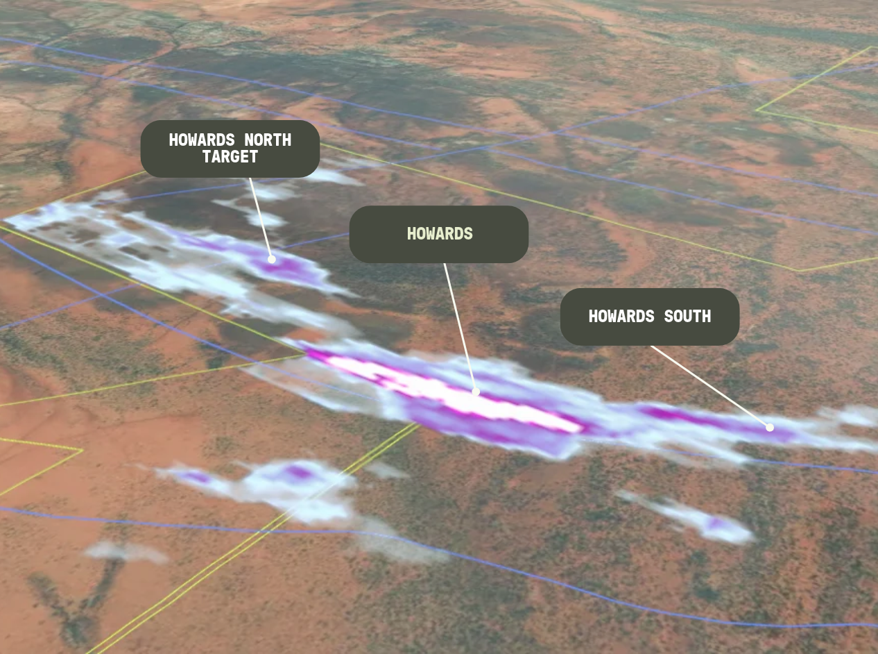
And it paid off. The first reverse circulation (RC) drilling of a target identified by Horizon Gold using DORA returned 2m at 1.53 g/t Au from 64m, indicating a possible untested footwall lode.
Background Geology
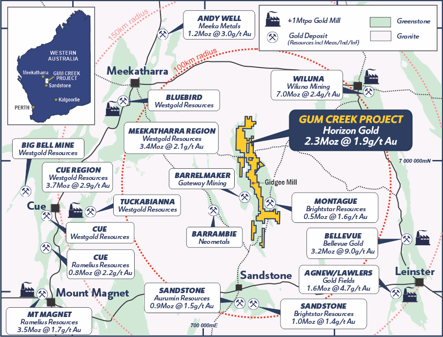
Located in the southern Gum Creek Greenstone Belt of Western Australia, Horizon Gold’s Gum Creek Gold Project is a gold camp situated near prolific multi-million-ounce gold deposits including Big Bell, Wiluna, Mt Magnet, and Agnew-Lawlers.
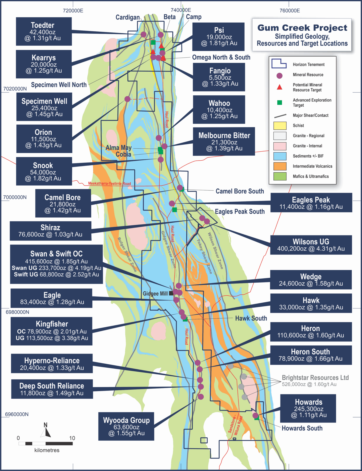
More specifically, Gum Creek hosts a JORC (2012) Mineral Resource of 37.97 Mt at 1.89 g/t Au for 2.30 Moz gold (March 4, 2026), with historic ore predominantly from weathered and lateritic zones. Known gold deposits occur as lensoid zones and pods of quartz-goethite-limonite vein swarms and stockworks with some lateral halo of gold into the wall rock. The ore zones are generally parallel to the regional strike, but can cut across lithological boundaries. Howards, 28 kilometres southeast of the historic Gidgee mill, contributes 6.8 Mt at 1.1 g/t Au for 245,300 oz of gold and is hosted in a north-south, steeply west-dipping shear zone with more than 1.3 kilometres of strike, open at depth and along strike.
The Why
Horizon Gold had no shortage of data at Howards. Three decades of drilling, geochemistry, and geophysics built a detailed picture of the district, but it was fragmented across campaigns, operators, and data types.
Reconciling this data into a single, consistent targeting model using traditional methods was slow and leaned heavily on subjective interpretation. Because of this, drilling had concentrated on the main Howards shear zone, leaving the surrounding ground comparatively untested.
With this context in mind, the team formulated two strategic goals:
- Find a faster way to integrate the full dataset
- Implement an objective, repeatable check on their own targeting
They were able to achieve both using DORA alongside conventional interpretation, using AI to complement the expertise of their technical team.
The Process
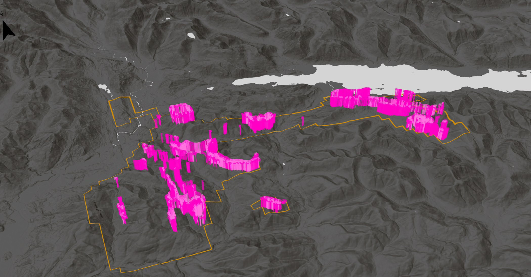
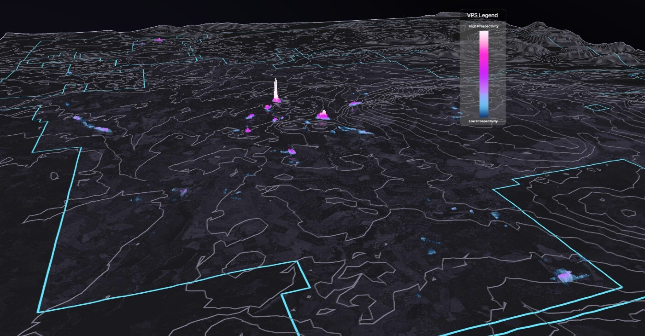
Horizon Gold and applied DORA at two scales:
- The wider Gum Creek district
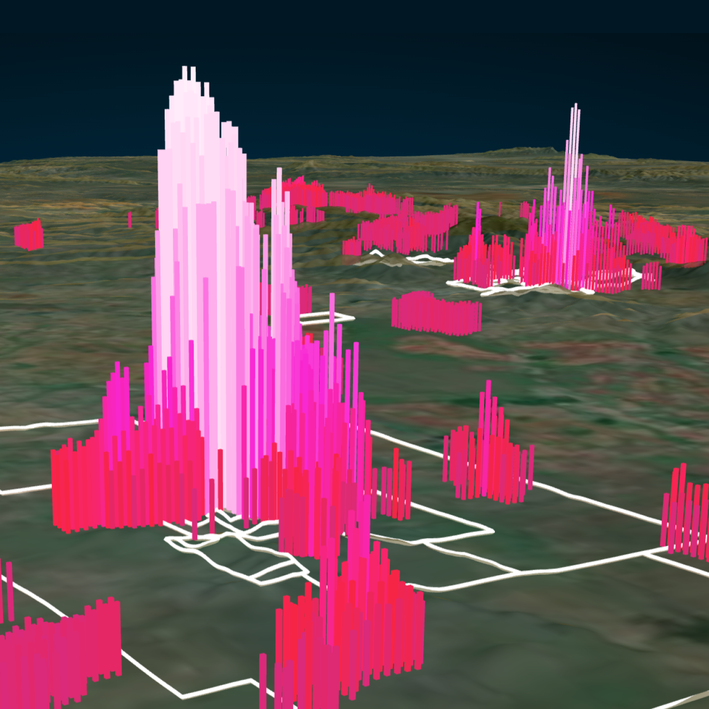
- In detail at Howards
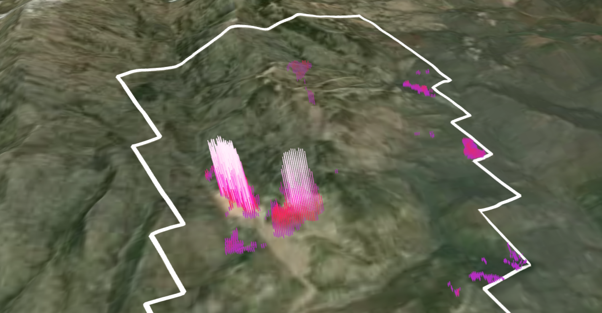
Geochemical, geophysical, and structural datasets were integrated into a single modelling environment to enable rapid hypothesis testing in DORA. Several prospectivity models were tested. The top performing model was a 14-layer Au-Cu model at Howards, which captured the known mineralization — a key validation step — and flagged new targets beyond it that were geologically sound.
DORA ranked the inputs by how strongly they predicted gold. The top input features were:
- Regional gravity signatures
- Proximity to mapped structures and fault disturbance
- Magnetic signature filtered with computer vision
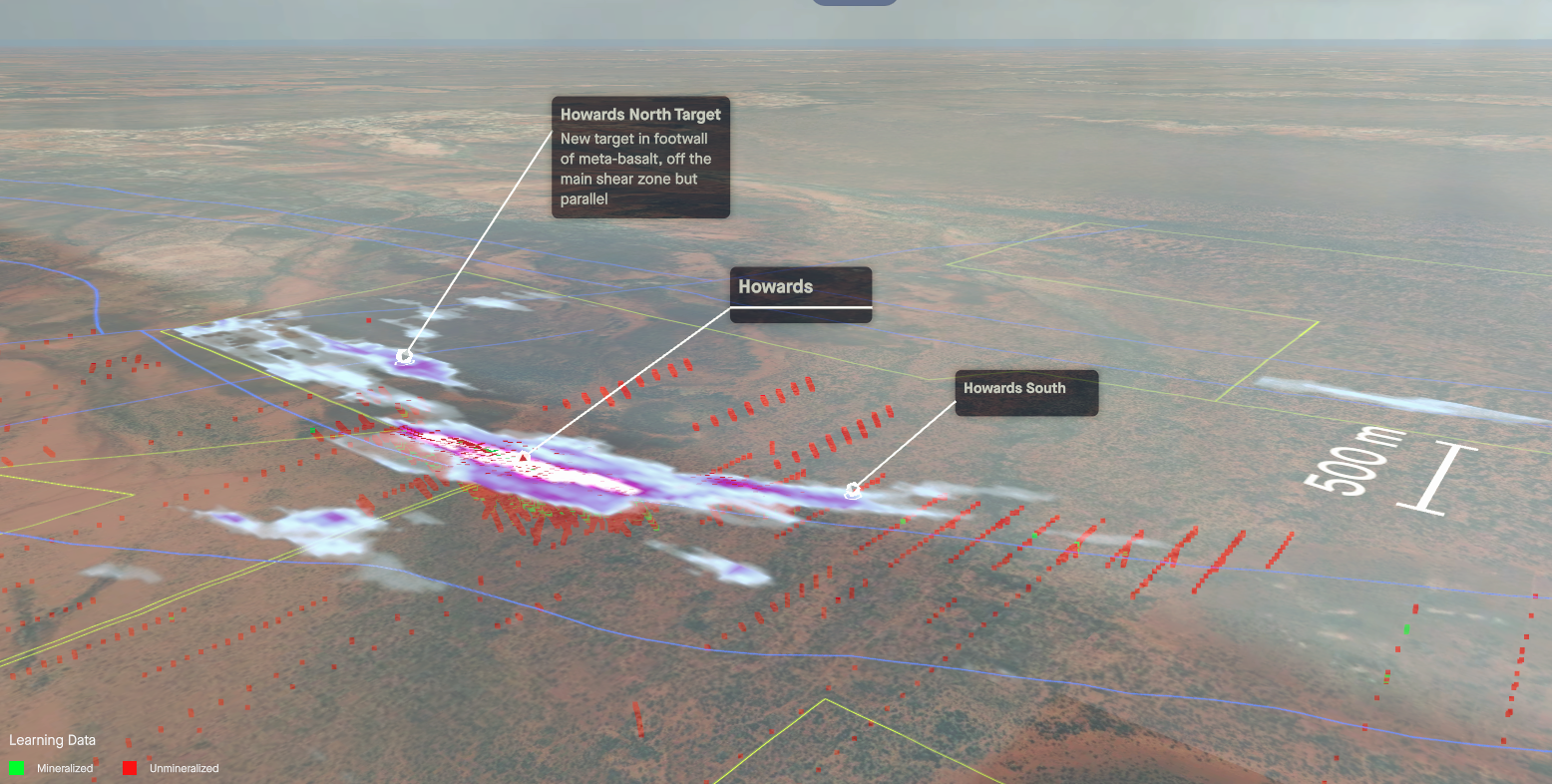
Because DORA clearly identifies which data layers influence each target across all models tested, Horizon Gold was able to evaluate the results against their own geological interpretation. This transparency allowed the team to understand and interrogate the outputs, rather than rely on conclusions generated by a black box. By combining AI with geological expertise, Horizon Gold was able to make more data-backed decisions about where to focus their exploration efforts.
The Outcome
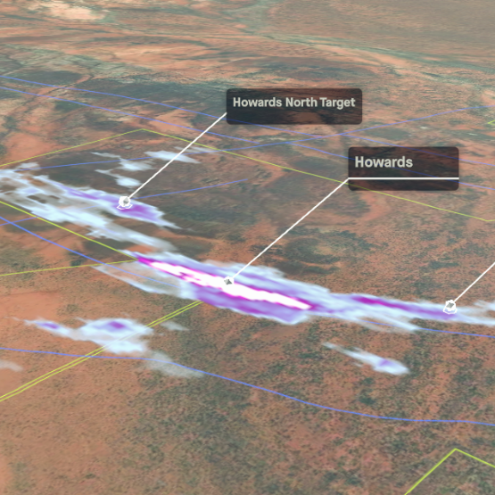
DORA flagged a new target approximately 900 metres north-northeast of the main Howards resource in ground that had not previously been drilled. Horizon Gold subsequently tested it with three RC holes.
One hole, HNRC001, returned two metres @ 1.53 g/t Au from 64 metres. The mineralization lies approximately 300 metres into the footwall of the Howards mineralization and could represent an untested footwall lode.
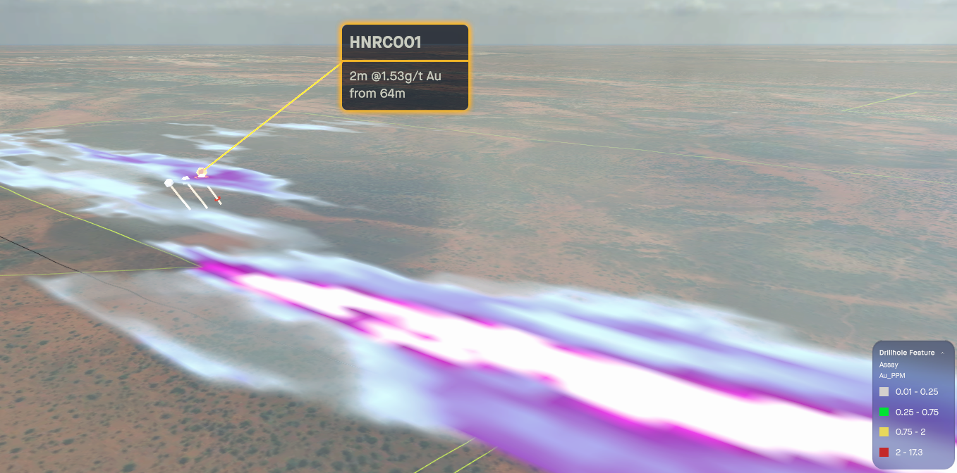
For a deposit drilled over three decades, a new zone outside the known envelope and deeper into the footwall volcanics is a meaningful result. It suggests Howards may hold more than its current 245,300 oz resource, and highlights the value of implementing AI to conduct data-driven validation on established interpretation. By combining AI insights with geological expertise, Horizon Gold turned decades of fragmented data into actionable exploration. With promising initial drill results, the team is now considering follow-up drilling to further investigate potential mineralization.
DORA identified a target offset to the northeast of the main Howards trend characterized by crosscutting magnetic lineaments coincident with a strong SkyTEM gradient. We completed some shallow RC drilling that identified gold mineralization at the centre of the target. We’re now considering follow-up drilling.
Leigh Ryan, VP Exploration, Horizon Gold
Read more about this update here.
<hr />
Explore what’s possible when you bring fragmented data together. Book a demo with our team.